Drone AI Services
Advanced Aviation Intelligence Technologies for Building and Environmental Management
Customized AI-driven aerial photography solutions to meet your industry-specific needs
We provide advanced and customized professional aerial AI services - object recognition, thermal imaging, environmental monitoring and crop analysis - designed for construction contractors, property owners, government agencies and institutions. Feel free to contact us by email/WhatsApp/call for inquiries or to get the latest quotes.
Aerial photography services

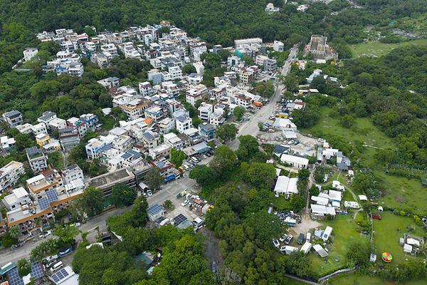
Aerial Object Identification and Counting
Using our AI-driven aerial imaging technology, we can accurately identify and count specific objects such as trees, buildings, solar panels, vehicles, road signs or people. Our advanced algorithms provide precise quantitative data for urban planning, infrastructure management and environmental assessment.

Aerial Dimension Measurement and Analysis
Combining high-resolution aerial imaging and AI analysis to measure the dimensions of building structures, properties or natural features. Our technology provides accurate spatial data for building planning, land surveying and property valuation, reducing labor costs and improving efficiency.

Aerial thermal imaging analysis
Detect temperature changes over large areas with our advanced thermal imaging drones. Our AI technology identifies heat loss, electrical hot spots, equipment failures or thermal anomalies in buildings, helping you improve energy efficiency, prevent equipment failures and strengthen safety protocols.

Aerial air quality measurement
Monitor air quality at various altitudes around construction sites, industrial facilities, or urban areas. Our specialized sensors collect comprehensive environmental data to assess pollution levels, ensure regulatory compliance, and protect public health and safety.

Aerial photography of crop yield analysis
Assessing agricultural productivity through AI-driven image recognition technology. Our drones capture detailed images of farm fields to identify growth patterns, detect diseases, estimate yields, and monitor irrigation effectiveness, enabling data-driven agricultural decision-making and improving productivity.

Customized AI analysis solutions
Develop specialized aerial data collection and AI analysis systems for your industry needs. Our team creates custom algorithms and reporting tools to transform aerial data into actionable insights for specific applications and decision-making processes.
Project Demonstration
Technology and methods

Advanced AI Application Technology
Our aerial AI service uses the most advanced drone technology, high-resolution cameras, professional sensors and proprietary AI algorithms to provide accurate and reliable decision-making data.

Data processing
We transform complex aerial data into clear, actionable insights through advanced AI processing, delivering results in custom formats that integrate seamlessly with your existing workflows.

Quality Assurance
Each AI analysis undergoes rigorous quality control measures to ensure the accuracy, reliability, and consistency of the results, meeting industry standards.
Service Industry

Construction and Development

Government and Public Infrastructure

Property Management

Agriculture and Land Management

Environmental Monitoring

Urban Planning and Smart Cities
Contact Us
Phone: +852 6235 7996 (WhatsApp Available)
Email: colens@coxana.com
Mail: West Wing, 2/F, 822 Lai Chi Kok Road, Cheung Sha Wan, Kowloon

